Cat Island Bahamas:
Your Ticket to Rest and Relaxation
If you want to get away from it all, Cat Island Bahamas is a great place to go.
It is pretty much undiscovered, doesn't have any big development on it and is a very laid back island.
In fact, this is where we went on our honeymoon, after getting married on Antigua. It is that quiet.
So, obviously, we didn't go here for a scuba dive vacation, but we did do some scuba diving while we were there.
We stayed at Fernandez Bay Village and absolutely loved it. It is on a gorgeous bay and was just what we wanted for a honeymoon destination.
I believe more houses have been built on the bay since we were there so it may not be as secluded as it once was. However, I am sure it will still be lovely and we will get back there one day.
Since Fernandez Bay Village didn't have a divemaster, we made arrangements to dive with Greenwood Beach Resort which is about 45 minutes from Fernandez Bay (you can read more about Cat Island Bahamas diving below).
But if you are looking for a quiet island, don't need nightlife or fancy resorts and just love to hang out on a quiet beach (and island), I can recommend Cat Island Bahamas and Fernandez Bay Village without hesitation.
In fact, Sports Illustrated did a swimsuit photo shoot at Fernandez Bay Village a while back so the backdrop has to to be gorgeous!
So start planning that getaway to some peace and quiet.
Cat Island Bahamas
Lay of the Land
Cat Island Bahamas is a fish hook shaped island is about 4 miles wide and 50 miles long. It is the sixth largest island in the Bahamas.
One story is that it is named after a pirate, Arthur Catt, but you can take your pick of which story you believe.

Like all the out islands of the Bahamas, it is a pretty flat island. However, Cat Island Bahamas does have the claim to fame that it is home to the highest point in the Bahamas, the 206 feet high Mount Alvernia, which is topped by a stone monastery.
So when I said the out islands are flat islands, I wasn't kidding.
As I said previously, it is still relatively undiscovered, helping it to retain its charm with no big developments or resorts.
The main towns on the island are Arthur's Town, Port Howe and Orange Creek and the population of the island is only about 1,600 people.
Location and Flights to Cat Island
Cat Island is located right in the center of the Bahamas, near the Tropic of Cancer and between Long Island and Eleuthera.
The island is located 130 miles south-east of the island of Nassau and 325 miles south-east of Miami.
It has two airports, Arthur's Town Airport and New Bight Airport. If you are staying at Fernandez Bay Village in Cat Island Bahamas, you would fly into the New Bight Airport.
Continental and LynxAir offer direct flights from Fort Lauderdale to Cat Island three times a week. These flights take about one hour and fifteen minutes.
To reach Cat Island from Miami, you will need to first fly to Nassau (Bahamasair or American Airlines are two options), a 55 minute flight, and then fly onto Cat Island.
From Nassau, Cat Island Air offers daily flights to Cat Island and Bahamasair offers twice weekly flights. The flight from Nassau takes less than an hour.
Maps of Cat Island
I have several maps for you to use.
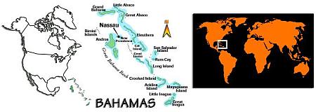
The first image is a clipart rendering just pinpointing the location of the Bahamas. Starting with the big picture here.
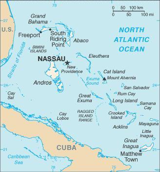
Next up is a map of the Bahamas to show you Cat Island's location within the Bahamas chain (you can find more maps of the Bahamas here if you would like some other views).
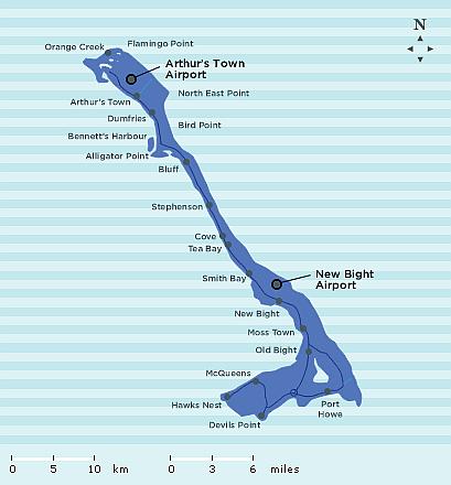
Next is a Cat Island map showing the major settlements and towns.
This map is courtesy of Bahamas.com, the official website of the Bahamas.
Weather
Cat Island Bahamas has a sub-tropical climate with warm, dry winters and hot summers.
|
Although summers can be hot and humid, the trade winds do offer welcome cool breezes to make the days more comfortable.
Winters are short, with daytime temperatures in the high 60s, and summers see temperatures rising to the mid 80s. Average daytime temperatures range between 68ºF and 86ºF, with nights ranging between 62ºF and 70ºF.
The rainy season in the Bahamas is between May and October. June is generally the wettest with an average rainfall of around 9 inches.
Like the rest of the Caribbean, hurricane season in the Bahamas runs from 1st June to 30th November.
On average, Cat Island is affected by or brushed by a hurricane every 3.11 years and suffers a direct hit (within 40 miles) once every 11.4 years. Hurricane Frances was the last hurricane to cause heavy damage. The eye of this hurricane passed over Cat Island, Bahamas, in 2004 (hurricane info per hurricancity.com).
Water Temperatures
Ocean temperatures for Cat Island diving, range from around 76ºF in winter to the low 89ºF in summer.
You will probably want to wear a wetsuit in the winter. You are probably good to go without one in the summer if you don't get cold easily.
With these temperatures you can dive year round. Visibility can get over 100 feet. When we did some Cat Island diving, our visibility was right around the 100 foot mark. Not too shabby.
Reefs and Rides
Cat Island is a nice place to do some diving.
There are dive centers at the Hawks Nest Resort and at the Greenwood Beach Resort.
They both offer great diving along the island's south end wall which stretches for about 12 miles.
|
This wall is covered with sea fans, sponges and corals and offers great opportunities to see sharks and grouper.
The wall drops to over 5000 feet in depth, but has a fringing coral reef on the shore-side of the wall, at depths of 65 to 115 feet, and patches of reef interspersed with coral sand at depths of 33 to 65 feet.
Fernandez Bay Village arranged our dives with Greenwood Beach Resort. When we dove on Cat Island Bahamas, it was just myself and my husband along with the divemaster and his girlfriend.
No crowded dive boats here. We drove from Greenwood to the boat but it wasn't a long ride so no big deal.
Since we were on our honeymoon, we only did a couple of dives.
The water was calm and they were an easy boat rides. The water temperature was 80 degrees on top and 78F at depth (this was in February).
First we went to a dive site called the "Anchor". This is a wall dive that started at about 65 feet. Our max depth on this dive was 98 feet and visibility was around 100 feet.
Unfortunately, the thing that sticks out in my mind about this dive is that the divemaster's girlfriend broke off a purple seafan and took it back with her. What the heck is that about? We couldn't believe it. I certainly hope that practice has stopped over the years (and I'm sure there are new people there - this was quite a few years ago).
Our second dive site was called the "Chimney". There was a fairly tight swim-thru here. You started at 30 feet and came out at 70 feet. Very nice. Our max depth on this dive was 80 feet.
Visibility on this dives was a little less than the first dive = about 75 feet.
Topside
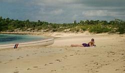
Like many small, undeveloped islands, it's all about relaxation on Cat Island Bahamas. There is not alot of "must do" on this island - and that's the whole point of being here anyway, isn't it?

|
On one of the days we were on the island, we rented a car to explore and drive around the island. It's always nice to get out for one day anyway and see what else is (or isn't, as the case may be) around.
Don't expect nice, new shiny rental cars. At least that wasn't our experience. We had an old boat with the ceiling cover falling down. Hey, it added to the experience and it got us where we wanted to go.
It's also worth a trip up "Mount" Alvernia to see the hermitage built by Father Jerome. He was a Roman Catholic priest and built this monastery by hand. It really is quite a feat and worth some of your downtime.
If you go, just chill out relax and enjoy. That's what Cat Island Bahamas is all about. Have fun!
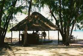
License photo by woody1778a. Thanks!
Go to our main Bahamas Page
Return to Scuba Diving Home
What's New
-
Unofficially Summer
May 25, 24 07:19 AM
Well it is finally here. Memorial Day weekend and the unofficial start of summer! Wishing everyone a happy and healthy holiday weekend. Hopefully the weather cooperates wherever you are and you will b… -
Happy New Year
Jan 01, 24 06:00 AM
Happy New Year everyone! I hope everyone is well and had a fun New Years Eve! May your new year be filled with lots of wonderful dives. All the best to you and yours in 2024! Let the dives begin. -
Happy Holidays
Dec 14, 23 05:05 AM
I hope everyone is enjoying the holiday season! I am always amazed at how fast time flies and another year is just around the corner. I wanted to pop in and say hi to everyone. I am doing some full ti… -
3 Common Scuba Diving Mistakes New Divers Make
Feb 23, 23 02:18 PM
 In this video, I share 3 common scuba diving mistakes beginner divers make. Learn how to correct these for a better - and safer - dive.
 -
Scuba Diving Tipping Etiquette: How Much And When To Tip Scuba Crew
Feb 06, 23 03:34 PM
Not sure of scuba diving tipping etiquette? In this video I share who to tip, when to tip, how much to tip, tipping on liveaboards, tipping an instructor & more


Click below to grab our free report and weekly actionable tips:

Popular Pages
 |
 |
 |
 |


New! Comments
Have your say about what you just read! Leave me a comment in the box below.